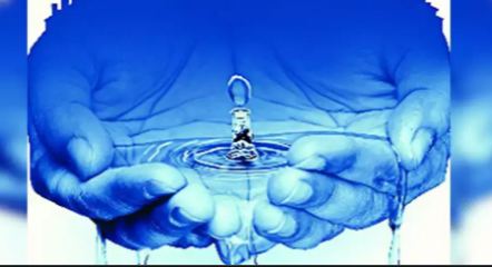
As per the figures of Central Ground Water Authority as shared by the state authorities, groundwater has been over-exploited in 85 of the total 141 blocks of the state.
With groundwater being exploited at a rapid pace in almost 79 per cent of Haryana, state authorities have now planned to check every village to map the the depleting water level.
As per the figures of Central Ground Water Authority as shared by the state authorities, groundwater has been over-exploited in 85 of the total 141 blocks of the state.
As much as 100 per cent groundwater against the recharge volumes has been exploited in these areas. This means if the groundwater is recharged with 100 litres, then the extraction of groundwater is more than 200 litres there. In the similar terms, the pace of exploitation of groundwater is 90 to 100 per cent in 12 other blocks which have been put in the category of ‘critical’ while fourteen more blocks have been put in the category of ‘semi-critical’ where the groundwater has been exploited in the range of 70 to 90 per cent against the recharge. Only 30 blocks have been declared in the safe zone.
“Even here, it’s not that water is being harnessed to use it judiciously. The issue is that the water is highly saline here. This water is neither usable for agriculture purposes nor portable,” says an official.
On an average, officials say, the state has witnessed an average decline of 9.47 metres in the water table from June 1995 to June 2020.
“In Kurukshetra, Karnal, Kaithal, Fatehabad, Panipat and Sirsa district water table declined sharply due to sowing of paddy, while in Gurgaon and Faridabad districts water table declined sharply due to urbanisation. In districts Bhiwani, Rewari and Mahendragarh, there is depletion of ground water due to availability of ground water in fractured zones of hard formation,” the officials say.
In a recent meeting Haryana Chief Minister had stated: “The groundwater level has gone down to 80 feet in some districts including Kurukshetra, Karnal, Kaithal and Panipat in the past five decades, which is a serious problem.”
Explaining the problem, state Project Director of Atal Bhujal Yojna, Satbir Singh Kadian, says: “Haryana is a water deficit state in terms of surface and groundwater resources. The groundwater level in the state particularly in the fresh groundwater zone is depleting fast due to overexploitation of ground water. The groundwater resource is under great stress as more than 60 per cent area is irrigated from groundwater sources due to limited availability of surface water in the state.”
Further, Kadian says, the groundwater quality in 45 per cent of the state’s area is not good for irrigation due to salinity as electric conductivity exceeds the permissible limits there.
Now, the government has planned to focus on every village to find out the gravity of the problem.
Kadian, who is a chief engineer level officer, says: “A water security plan will be formulated for each of the villages in 85 blocks. We will tell the villagers for how long the groundwater will sustain if its exploitation continues at the current pace. We will ask them whether they wish to remain without ground water in future. Alternative crops in place of paddy to save the water will be suggested apart from telling the ways for water conservation and artificial recharge of groundwater. The call to decide the fate of their future will be left on the community itself. This formula has yielded positive results in different parts of the world.”
Out of 85 over-exploited blocks, officials say, as many as 36 blocks will be covered under the Atal Bhujal Yojana while the state will intervene for the remaining blocks with its own resources. A participatory groundwater management scheme, the Yojana is supported by the central government and the World Bank. Haryana will get financial aid of Rs 678 crore to implement the scheme in four years.
Currently, the water level is checked at the radius of every 20 square km area but now they have plans to detect it in every village. Then the average distance will be just 6.5 square km. It will enhance the accuracy of water availability beneath the earth.
“We want to know which village is pumping out how much water and for what purposes. The idea is to make the invisible source of groundwater visible to the common man. It will personalise the challenge for every village.” As per the plan, the water availability index of each village will be prepared while implementing the water security plan over the next four years.