While China is rushing to complete a bridge across the Pangong Tso, connecting the north and south banks, India is also fortifying a black-topped road on its side on the north bank. With over a lakh troops deployed at LAC, India is scaling up its military infrastructure with bridges, tunnels, and forward repair points to thwart Chinese build-up.
Read More: Chinese President Xi Meets US State Secretary Blinken; Says Agreement Reached On ‘Some Issues’
After the violent Galwan clash between Indian and Chinese forces at the Pangong Tso which lies in eastern Ladakh and western Tibet — China is ramping up its military infrastructure, including new bridges. While China is rushing to complete a bridge across the Pangong Tso, connecting the north and south banks, India is also building a black-topped road on its side on the north bank.
A critical look at the military infrastructure along the Line of Actual Control (LAC) in 2020 pushes the Indian establishment to ramp up its infrastructure on a war footing.
What was needed is to build roads, tracks, bridges, military garrisons, habitats and shelters for troops in areas unoccupied earlier. The urgency was acute as the Indian army planned to position multiple divisions of more than 50000 troops along the LAC.
China broke the status quo, bringing its military towards the contested patrolling points at LAC which prompted India to recalibrate its strategy against Chinese aggression.
In response, among the high-priority projects, India is building a road towards Finger 4 on its side. At LAC, India has been commanding till Finger 4 which extended to Finger 8. In 2020, Chinese troops unilaterally broke the sanctity which led to the Galwan clashes.
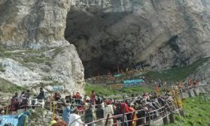
The area that is broadly marked as the north bank of Pangong Tso stretches along 135 km in various dimensions. Pangong Lake, situated at a height of almost 4,350m, is the world’s highest saltwater lake with around 45 kilometers on the Indian side of the LAC.
Read More: PM Modi’s US visit: Experts recommend these five defense stocks to buy today
While the construction is underway, the project is deemed as complex engineering over the treacherous mountain, capable of carrying military equipment. According to the official, the blacktopped road leading to Finger 4 will add the Indian army as an alternative for the Darbuk-Skyok-Daulat Beg Oldie Road through the Saser La.
The construction will link Sassoma along the Nubra river to Sasser La and Gapshan, further connecting the main 255-km long Durbuk-Shyok-DBO road along the LAC.
Indian defence entity, the Border Road Organization (BRO) is leading such strategic infra build-up along the LAC. The BRO is working on connecting the last mile in the eastern sector such as the Sela, Nechipu, and Sela-Chhabrela tunnels among other strategic passes.
So far, the BRO has completed 19 infrastructure projects in 2021 and 26 in 2022 in Ladakh alone and expects to complete 54 projects this year, as per the official data.
Under the strategic roadmap, India–China Border Roads (ICBR) plans the construction of over 1,400 km of strategic roads along the 3,488 km-long LAC under the three phases.
The last phase focuses on Arunachal Pradesh where the BRO has established repair points (FRPs) along the Line of Actual Control (LAC) to ensure efficient maintenance and repair, which shares 1,129 km of a total 3,488-km Sino-Indian border. The FRPs are crucial projects at LAC in repairing and functioning of military equipment.

Chinese roadmap
China has already built a bridge Pangong Lake which connects Peoples Liberation Army (PLA)’s Rutog military garrison to mountain ridges. Further south of the Depsang plains, the Chinese military has constructed military garrisons, which overlook the Indian military posts and patrolling.
Apart from building two bridges—main and secondary– China has established its air defence site located east of the Khurnak Fort.
China is also ramping up its connectivity project, which is a 22 km-long tunnel along the G-0177 expressway at Yuli, connecting to the G-216 highway in Tibet.
Failed talks
So far, India and China have held 18 rounds of military talks and 27 meetings of the Working Mechanism for Consultation and Coordination on India-China Border Affairs (WMCC).
However, the friction points remain on Depsang Plains and Demchok over the patrolling rights. Indian army has been patrolling in these areas until the Galwan clash which restricted the movement.
Read More: International Yoga Day 2023: 8 Actresses Who Swear By Yoga For That Svelte Body
The 18th round of talks which was held on the Indian side of the Chushul-Moldo border meeting point along the LAC in Eastern Ladakh hit a deadlock over a 972 sq km plateau — Depsang.
Major issues revolve around Depsang over troop positions and patrolling rights as the PLA has attempted to block the area unilaterally which was earlier being patrolled by the Indian army.