There has been a 7% deficiency in monsoon rain since June 1, with a 17% deficiency over east and northeast India, 16% over the South Peninsula, 6% over Central India and 8% excess over northwest India. In contrast, July ended with a 5% surplus of rain
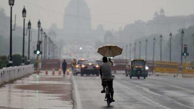
There is a 7% deficiency in monsoon rainfall mainly owing to prolonged weak or break monsoon conditions over the plains in August, the Indian Meteorological Department (IMD) has said.
The monsoon trough has remained to the north of its normal position largely from August 7 onwards, leading to extremely heavy rain and flooding over Himachal Pradesh and Uttarakhand.
Read More: After moon landing venture, ISRO eyes September 2 for launch of Aditya-L1 solar mission
The trough moved south for a couple of days but has been along the Himalayan foothills most of the time.
The monsoon trough is an elongated low-pressure area that extends from a so-called “heat low” (a low pressure over the seas) over Pakistan to the head of the Bay of Bengal region (parts of Odisha, West Bengal, and Bangladesh). This is one of the semi-permanent features of monsoon circulation, according to the IMD.
Subdued rainfall activity is expected over the plains for the next one week, IMD said on Saturday.
The western end of the monsoon trough continues to run along the foothills of the Himalayas. According to the IMD, it is likely to remain to the north of its normal position during the next five days.
The eastern end of the monsoon trough passes through Gorakhpur, Darbhanga, Balurghat and thence eastwards to Manipur. A cyclonic circulation is lying over west Assam in lower tropospheric levels, it said.
Read More: G20 Summit: Delhi Traffic To Be Affected On THESE Routes Today Due To ‘Carcade Rehearsal’
A trough is running from sub-Himalayan West Bengal to the Northeast Bay of Bengal in middle tropospheric levels.
A heavy to very heavy rainfall spell is likely to continue over the northeast, IMD said in its bulletin on Sunday. “Heavy to very heavy rainfall spell is likely to continue over Arunachal Pradesh, Assam and Meghalaya on August 27 and 28,” it said.
“Subdued rainfall activity likely over rest parts of the country during next one week,” added the IMD bulletin.
“Monsoon is unlikely to revive immediately. In fact, it will remain concentrated over the eastern Himalayas. For the next two days, it will be over the Western Himalayas,” said Mahesh Palawat, vice president, climate and meteorology, Skymet Weather.
There has been a 7% deficiency in monsoon rain since June 1, with a 17% deficiency over east and northeast India, 16% over the South Peninsula, 6% over Central India and 8% excess over northwest India. In contrast, July ended with a 5% surplus of rain.
“The models are suggesting there could be a revival of monsoon after September 4, though it may not be a strong revival. Till September 4, rain will be below normal and thus will bring down rainfall further. The question is how long the monsoon will be in normal activity. But it looks like it will be confined only to east-central India,” said M Rajeevan, former secretary, ministry of earth sciences and climate scientist.
Read More: ‘Nothing Wrong…’: ISRO Chief Over Naming Of Chandrayaan-3 Landing Site ‘Shivashakti’
He added that prolonged weak monsoon conditions are an impact of ongoing El Nino conditions. “El Niño impacts monsoon through extended breaks and keeping rainfall activity very close to foothills,” he said on Sunday.
“Monsoon trough is positioned northward for a long time due to various reasons. One is a sinking motion or suppressed atmospheric conditions over central India which pushes the monsoon trough northwards. Sometimes western disturbance pulls it up. But the basic reason for long breaks is atmospheric dynamics associated with El Niño. El Niño impacts Indian monsoon through these long breaks,” Rajeevan had said last Monday.
IMD’s extended range forecast also indicates the possibility of a weak revival after the first week of September.
Some states in eastern India and the peninsular region continue to record significant deficiency in rainfall. Nagaland, Manipur, Mizoram and Tripura have 25% deficiency as a region, Gangetic West Bengal 25%, Jharkhand 34%, Bihar and East Uttar Pradesh 25% each, Madhya Maharashtra 21%, Rayalseema 30%, Kerala and Mahe 47%, among others.
Equatorial sea surface temperatures (SSTs) are above average across the central and eastern Pacific Ocean.
The tropical Pacific atmospheric anomalies are consistent with El Niño. El Niño is anticipated to continue through the Northern Hemisphere winter (with greater than a 95% chance through December 2023-February 2024), the National Oceanic and Atmospheric Administration had said on August 21.
At its peak (November-January), a strong El Niño is indicated by the dynamical model average.
El Nino has a strong influence on the southwest monsoon in India. El Nino years are characterised by an unusual warming of waters in the eastern equatorial pacific, which has a high correlation with warmer summers and weaker monsoon rains in India.