Fairly widespread to widespread rainfall over Bihar, Bengal, Sikkim, Jharkhand, Arunachal Pradesh, Assam, Meghalaya and Nagaland, Manipur, Mizoram and Tripura during next 5 days
Moderate to severe thunderstorm accompanied by frequent cloud to ground lightning predicted over Bihar, Jharkhand and West Bengal during next 24 hours
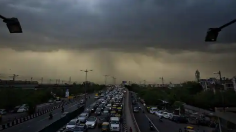
The India Meteorological Department (IMD) on Sunday issued a fresh weather update predicting moderate to severe thunderstorm and heavy to very heavy rainfall in some states till 8 July.
The department has predicted fairly widespread to widespread rainfall over Bihar, Bengal, Sikkim, Jharkhand, Arunachal Pradesh, Assam, Meghalaya and Nagaland, Manipur, Mizoram and Tripura during next 5 days.
it has also predicted isolated thunderstorm and heavy rainfall over Bihar on 4th-6th July; over Odisha and Gangetic West Bengal on 4th, 7th and 8th July; Jharkhand, Chhattisgarh on 7th-8th July; Arunachal Pradesh on 4th and 6th July; Assam and Meghalaya on 5th and 7th July and Sub-Himalayan West Bengal, Sikkim on 4th, 6th and 8th July.
According to IMD, isolated heavy to very heavy rainfall are likely to occur over Bihar on 7th-8th July; Assam and Meghalaya on 4th and 6th July; and Sub-Himalayan West Bengal on 7th July.
The department has also predicted moderate to severe thunderstorm accompanied by frequent cloud to ground lightning over Bihar, Jharkhand and West Bengal during next 24 hours.
“This may cause injuries leading to casualties to people and animals staying outdoors,” the IMD said.
For next two hours, the IMD has predicted thunderstorm with light to moderate intensity rain over isolated places of Narnaul, Mahendergarh, Loharu (Haryana), Kotputli, Rajgarh, Lachmanngarh, Mahwa, Mehndipur (Rajasthan) and adjoining areas.
In a separate update, IMD’s CS Patil informed that Karnataka might witness increase in rainfall from July 5. Yellow alert in North and South Karnataka has been issued for July 7-8. Bengaluru is likely to experience rain and thundershower in the next two days.
On Saturday, the IMD said that the prevailing meteorological conditions, large scale atmospheric features and the forecast wind pattern by dynamical models suggested that no favourable conditions were likely to develop for further advance of southwest monsoon into remaining parts of Rajasthan, West Uttar Pradesh, Haryana, Chandigarh, Delhi and Punjab during next 5 days.
“Hence, subdued rainfall activity is very likely to continue to prevail over Northwest, Central and Western parts of Peninsular India during next 5-6 days,” it added.
The department predicted isolated or scattered thunderstorm activity accompanied with lightning and rainfall is also likely over these regions during this period.
Heatwave conditions has also abated from the plains of Northwest India with occurrence of only isolated heat wave over Haryana on Friday. On 2 July, fairly widespread rainfall occurred over Punjab, Haryana, Delhi and adjoining parts of West Uttar Pradesh due to a Western Disturbance bringing respite from the prevailing Heat Wave conditions.
“Maximum Temperatures over the plains of Northwest India are likely to fall by 3-4°C today and no significant change is likely thereafter. Subsequently, no heat wave conditions are likely over the region during next 5 days,” the IMD said on Saturday.
The department had also predicted fairly widespread to widespread rainfall over Bihar, Sub-Himalayan West Bengal, Sikkim, Arunachal Pradesh and Assam and Meghalaya during next 5 days.
“Isolated heavy to very heavy rainfall very likely over Bihar, Assam, Meghalaya and Sub-Himalayan West Bengal and Sikkim during next 5 days,” IMD said.