The Safdarjung Observatory records a minimum temperature of 21.8 degrees Celsius, five notches below normal, on Monday.
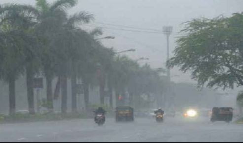
New Delhi: Partly cloudy skies and intermittent rainfall are predicted to keep temperatures in check in Delhi and heatwave conditions are unlikely to return for five to six days, the India Meteorological Department’s Regional Forecasting Centre said on Monday.
Read More: ISRO GSLV F12/NVS -1 Mission: Rocket Carries 2nd-gen NavIC Satellite
The Safdarjung Observatory, Delhi’s primary weather station, recorded a minimum temperature of 21.8 degrees Celsius, five notches below normal, on Monday. The maximum temperature is likely to settle around 35 degrees Celsius.
May, historically the hottest month in Delhi with a mean maximum temperature of 39.5 degrees Celsius, has recorded below-normal temperatures and excess rain this time. Meteorologists attributed the phenomenon to higher-than-usual western disturbances — weather systems that originate in the Mediterranean region and bring unseasonal rainfall to northwest India — this season.
Read More: Sisodia Generated Rs 622.67 Cr POC in Excise Policy Scam: ED
According to India Meteorological Department (IMD) data, the Safdarjung Observatory has so far recorded 86.7 mm of rainfall in May. On average, the national capital logs 19.7 mm of rainfall in the whole month.
Delhi also witnessed an unusual episode of dense fog earlier this month. The minimum temperature dropped to 15.8 degrees Celsius on May 4, making it the third coolest May morning since the IMD started keeping records in 1901.
The city logged more than 20 mm of rainfall in April, the highest in the month since 2017. Delhi recorded maximum temperatures above the 40-degree mark for just nine days in May with heatwave conditions affecting some parts for a brief period.
Read More: PM Modi to Flag Off Northeast’s 1st Vande Bharat Train Today; Check Routes, Timings & Other Details
The Safdarjung Observatory has not recorded any heatwave days this season so far. The threshold for a heat wave is met when the maximum temperature of a station reaches at least 40 degrees Celsius in the plains, 37 degrees in the coastal areas, and 30 degrees in the hilly regions, and the departure from normal is at least 4.5 degrees.
According to the IMD, a fresh western disturbance will bring gusty winds, rain, and even hail to some places on Monday and Tuesday. The maximum temperature is predicted to remain below the 40-degree mark until June 4. Earlier this month, the weather office predicted below-normal maximum temperatures and fewer heatwave days in northwest India in May.