Even as Cyclone Biparjoy has further weakened to very severe cyclonic storm over the northeast Arabian Sea, the India Meteorological Department (IMD) has sounded an Red alert as cyclone warning for the Saurashtra and Kutch coasts. Moving north-northeastwards with a speed of 5 km per hour, Cyclone Biparjoy at 2.30 am lay centred at 90 km southwest of Jakhau Port (Gujarat), 300 km west-southwest of Devbhumi Dwarka, 310 km west-southwest of Naliya, 350 km west of Porbandar, and 370 km south-southwest of Karachi (Pakistan).
Read More: Toll charges on Bengaluru-Mysuru Expressway hiked by 22%; here are the new rates
The cyclone is expected to move nearly north-northeastwards and cross Saurashtra and Kutch and adjoining Pakistan coasts between Mandvi (Gujarat) and Karachi (Pakistan) near Jakhau Port (Gujarat) by Thursday evening of as a very severe cyclonic storm with maximum sustained wind speed of 125-135 km per hour gusting to 150 km per hour.
Read More: Delhi Govt to Bring One-time Settlement Scheme for Water Bills of 11.7 Lakh Consumers with Arrears
Here are the top 5 updates on Cyclone Biparjoy
- 01 Heavy rainfall warningKachchh, Devbhumi Dwarka, Porbandar, Jamnagar, Rajkot, Junagarh and Morbi districts of Saurashtra and Kutch are expected to receive light to moderate rainfall at most places with heavy to very heavy rainfall and extremely heavy falls at isolated places on Wednesday. The intensity of rainfall is likely to increase on Thursday.
- 02 IMD warns of flood in Gujarat districtsAccording to IMD, a storm surge of about 2 -3 metres above the astronomical tide would likely inundate the low lying areas of Kachchh, Devbhumi Dwarka, Porbandar, Jamnagarh and Morbi districts of Gujarat during the time of landfall of the cyclone. The astronomical tides along these districts could be up to 3-6 metres in different places.
- 03 Phenomenal-rough sea conditionWith Cyclone ‘Biporjoy’ intensifying, high tidal waves have hit the Gujarat coasts. According to the IMD, The sea condition is likely to be phenomenal over the northeast and adjoining eastcentral Arabian Sea till the evening of Thursday evening, and rough to very rough over adjoining northwest Arabian Sea and rest parts of eastcentral Arabian Sea during the same period. The Met department added that the condition of the sea is expected to be rough to very rough till Wednesday morning and high to phenomenal thereafter till Thursday evening. It would improve thereafter.
- 04 Trail of destructionsThe weather department has predicted a total destruction of thatched houses and extensive damage to kutcha houses during the period. Some damage could be caused to pucca houses too. The rough weather conditions can also result in bending and uprooting of trees and communication polls, cause major damage to kutcha and pucca roads, and flood escape routes. Widespread damage to standing crops, plantations, orchards, falling of green coconuts, tearing of palm fronds, and blowing down of bushy trees like mango are also expected.According to the IMD, the train services and power supply can be disrupted due to the unfavourable weather conditions in the northwest coast of India.
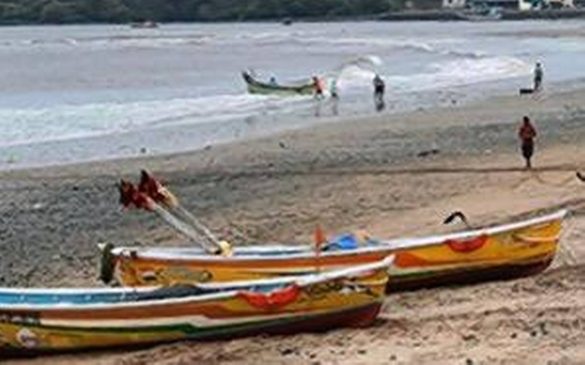
- 05 Precautions, preparations in placeThe IMD has advised total suspension of fishing operations over eastcentral and adjoining eestcentral Arabian Sea Thursday and over northeast Arabian Sea during Wednesday and Thursday. Those who have ventured into the sea have been advised to return to coast at the earliest. People in affected areas have been advised to remain indoors while tourism activities in these areas have been restricted. Ports and naval base operations along the west coast of India will take necessary precautions if needed, and evacuation from coastal areas of Saurashtra and Kutch will be mobilised.