Heavy to very heavy rainfall is likely over Uttarakhand, Himachal Pradesh, Northern parts of Uttar Pradesh, Bihar, West Bengal, Sikkim and other parts of Northeast India during next 3-4 days.
The India Meteorological Department (IMD) in a statement on Tuesday (August 22) informed that heavy to very heavy rainfall is likely over Uttarakhand, Himachal Pradesh, Northern parts of Uttar Pradesh, Bihar, West Bengal, Sikkim and other parts of Northeast India during next 3-4 days and decrease thereafter.
The Met department also said that isolated extremely heavy rainfall is likely over Uttarakhand on August 23 and 24, 2023.
“Monsoon Trough lies to the north of its normal position. It is likely to remain north of its normal position during the next 7 days,” IMD said.
Read More: Now, Batting Legend Sachin Tendulkar to Raise Voter Awareness as ‘National Icon’
Uttarakhand on Red Alert
The already rain-soaked Uttarakhand looks set to witness an even stronger rain spell come Wednesday and Thursday, August 23-24. In view of the extremely heavy showers, IMD has issued a red alert over the Himalayan state during this 48-hour period.
The Regional Met Centre in Dehradun has issued red warning in six districts – Dehradun, Tehri Garhwal, Pauri Garhwal, Nainital, Champawat and Udham Singh Nagar on Wednesday and Thursday. The Met Office has also issued a red alert for Bageshwar and an orange alert for Haridwar for today.
Read More: Chandrayaan-3 All Set to Make History With Soft-landing on Moon | When & Where to Watch
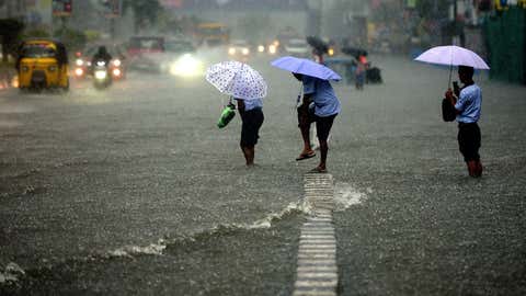
Rain lashes parts of Delhi-NCR
Rainfall lashed parts of Delhi and the National Capital Region, including Ghaziabad and Noida, on Wednesday morning, bringing much-needed respite from sultry weather conditions experienced over the last few days. According to the forecast by the Met Office, thunderstorms with light to moderate-intensity rainfall are likely in the parts of Delhi-NCR today.
“Thunderstorm with light to moderate intensity rain and gusty winds with speed of 30-50 Km/h would occur over and adjoining areas of many Places of Delhi (Seemapuri, Shahadra, Vivek Vihar, Red fort, Preet Vihar, ITO, India Gate, Akshardham, Lodi Road, Nehru Stadium, Defence Colony, Lajpat Nagar, Vasant Kunj, Hauzkhas, Malviyanagar, Kalkaji, Tughlakabad, Chhattarpur, IGNOU, Ayanagar), and NCR ( Loni Dehat, Hindon AF Station, Ghaziabad, Indirapuram, Chhapraula, Noida, Dadri, Greater Noida, Faridabad, Ballabhgarh) Gannaur, Sonipat, Sohana, Palwal, Aurangabad (Haryana) , Shamli, Muzaffarnagar, Kandhla, Bijnaur, Khatauli, Sakoti Tanda, Baraut, Daurala, Bagpat, Meerut, Khekra, Modinagar, Kithor, Garhmukteshwar, Pilakhua, Hapur, Gulaoti, Siyana, Sambhal, Sikandrabad, Bulandshahar, Jahangirabad, Anupshahar, Bahajoi, Shikarpur, Khurja, Pahasu, Debai, Gabhana, Jattari, Nandgaon, Barsana (U.P.) during next 2 hours,” the Regional Weather Forecasting Centre (RWFC) in Delhi tweeted.
Read More: Arvind Kejriwal announces public holiday in Delhi from Sept 8-10 for G20 mega event – Top 5 points
Heavy rainfall likely in Himachal Pradesh
The weather department has predicted moderate to heavy rainfall accompanied by thunderstorms in many places in the state of Himachal Pradesh today.
According to IMD’s latest weather bullitine, heavy to very heavy rainfall is likely to occur in a few places in the Districts of Kangra, Chamba, Hamirpur, Mandi Bilaspur, Solan, Shimla, and Kullu today.
Weather alert for Northeast India
According to IMD, Northeast India is very likely to witness isolated heavy rainfall activity during the next four days.
“Isolated very heavy rainfall also likely over Assam & Meghalaya and Arunachal Pradesh during 22nd-26th August,” IMD said.